|
Western Armenia |
|
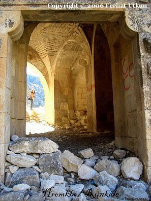
Khromkla Fortress, at present Rumkale. |
|
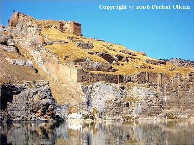
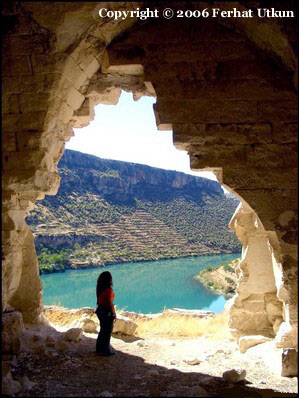
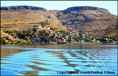
Khromkla. View from the Euphrates |
|
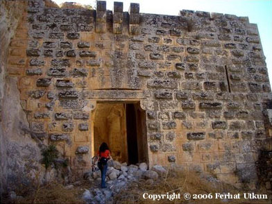
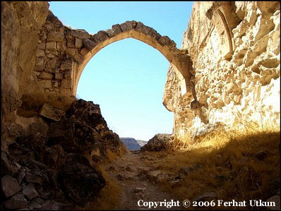
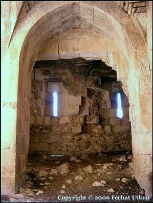
Western entrance to the fortress |
|
In an uninhabited area, on the right bank of the Euphrates between Gaziantep and Sanliurfa vilayets there stands a big fortress named Khromkla or Rumkale in Turkish. The fortress served as the residence of the Catholicos of All Armenians from 1149 till 1292. |
|
Before we step closer to the history of this place its necessary to say some words about Armenian Kingdom of Cilicia.
Vast territories taking their start from the Mediterranean sea and the towns situated close to its shores - Mersin, Tarsus, Adana, and stretching to the North-East up to Harberd (Harput, at present Elazig) were not originally Armenian. In XI century Byzantine Empire annexed Armenian lands of the Kingdom of Ani and Vaspourakan, whereupon Armenians began migrating from their domains to the inner lands of the Empire. In exchange to their old estates Byzants gave Armenian nobles lands on new sites intending to defence these territories and populate them by the Christians. The migration was so extensive that in 1080 the founder of Rubenides Dynasty Ruben I established Armenian Kingdom of Cilicia. The Kingdom successfully struggled against bellicose Islamic neighbours (Seljuks & Mamelukes of Egypt) for about three centuries.
Soon after the new Armenian Kingdom was founded in Cilician mountains, Byzantine Empire relinquished to Seljuks not only bloodless Armenian lands but also almost all the territory of Asia Minor. Contrary to this, Cilician Armenians formed different anti-muslim coalitions successfully opposing their enemies and had considerably enlarged their Kingdom's area.
Gregorian Church followed the people to the new centre of Armenian life. Having changed for less than a century three different locations (Thavblour, Dzamendav & Dzovk) the residence of Catholicos at last found its place in Khromkla Fortress and stayed there for a century and a half. At this place birth was given to many important decisions able to change the course of history. For example in 1779 in Khromkla at the Episcopal council Armenians rejected integration of Byzantium and Armenian Churches and refused to adopt Chalcedon as the Oecumenical council.
From the 2nd half of XIII century Armenian Kingdom of Cilicia had constantly been at war with Egyptian Mamelukes. As a result in 1280s many Christian villages located near Khromkla were ravaged and in 1293 the fortress itself had been captured. Throne of the Catholicos of All Armenians were replaced to Sis, the capital of the Cilicia and in 1375 the Kingdom were totally destroyed.
At present armenians live only in several villages in Hatay region near to Musa Dagh (Moses mount); dramatic events of the beginning of the 20th century were depicted in Franz Werfel's novel "The Forty days of Musa Dagh".
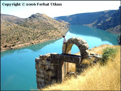
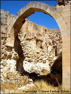
Until now Khromkla has a look of unassailable fortress. One still can find the remains of Surp Nerses Church as well as many caves and ruins. After the dam on Euphrates was erected the water level increased considerably almost turning the rock with the fortress into an island. At the same time narrow strip of fertile land cultivated by local Kurds, several villages and lower part of the town of Halfeti were completely flooded out. |
|
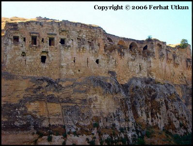
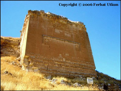
Southern tower. See below detailed images of its bas-reliefs. |
|
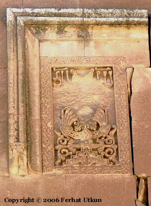
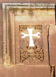
Bas-relief.
It obvious that on the bas-relief on the left previously there had been a cross later scraped and only small upper and lower parts remained of the cross.
On the small picture on the right I have shown how khachkar might have looked before its destruction. You can see sample of classic armenian khachkar here. |
|
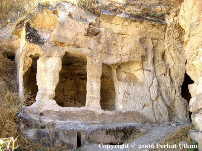
Ruins near the western entrance. |
|
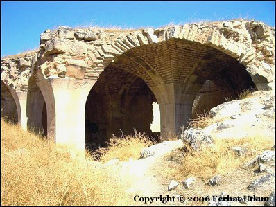
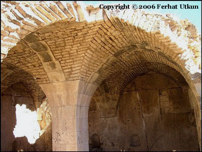
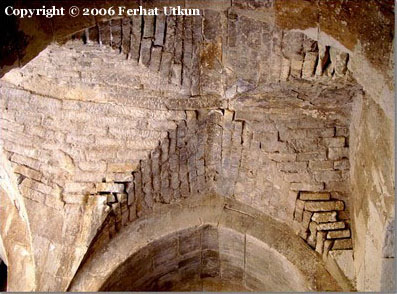
Fragment of Zhamatun. This is all that remains from Surp Nerses Church. |
|
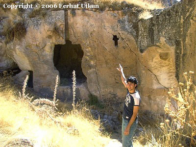
One of the caves inside the fortress. On the right Ferhat, the autor of the photos, points to cross-shaped window. |
|
Halfeti, town half flooded by the Euphrates. |
|
The author expresses his personal appreciation of the assistance given by Ferhat Utkun. This page wouldn't have appeared without his photos. |